The wall of Farmers General (Fermiers généraux)
Between the Cours de Vincennes and the Place de la Nation stand two columns, the function of which is not particularly obvious. In fact, it is a vestige of the enclosure of the “Fermiers généraux” (the Farmers general), an enclosure that has left its mark on all of Paris.

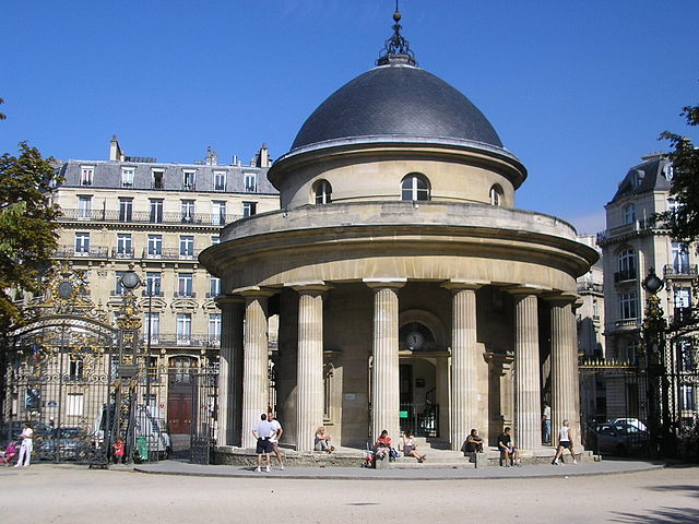
The columns adorned one of the gates that allowed people to cross the enclosure and enter Paris. Three other remains of this type are known, also located at the gates. The surrounding wall has completely disappeared.
A fiscal enclosure
In general, when an enclosure is built around a city, it is to protect its inhabitants from external dangers. Here however, there is no defensive vocation, the enclosure is only intended to levy taxes.
Before the Revolution, the state did not directly collect all taxes. It leases to financiers, for a period of 6 years, the right to do so. It is said that these financiers take the right to farm, hence their name of farmers. They are even “general” farmers because, since Colbert, the rights on goods entering Paris are included in a large package including other taxes.
Farmers General therefore advance a large sum of money and reimburse themselves (if possible with profits) by levying taxes. We can therefore understand their motivation to reduce fraud as much as possible. To this end, in 1785, they obtained from Louis XVI the right to build a real wall, forcing everyone to go through gates to enter the city (and in the process, they also enlarge the perimeter a little, as there are no small profits). The wall is quite imposing since it is 24 kilometers long and 3 meters high. Proof of their great motivation, the farmers general completed it in just 18 months.
Probably, to sweeten the pill, the architect Claude-Nicolas Ledoux created beautiful monuments, in a style freely inspired by antiquity, which adorn each of the barriers allowing entry into the city. There were 55! But Parisians were not overly sensitive to the charm of these buildings. The Passy barrier, for example, was attacked on July 13, 1789. However, everything was restored in 1798 and taxes were levied again until 1860, when Paris was extended to its current limits. Then the wall was broken down.
Remains and traces of the enclosure
This map details some traces left by the enclosure. Four barriers are therefore still visible, but there are also more discreet signs in today’s Paris.
First, the enclosure led to the creation of wide boulevards which form a ring around the historic center. This later enabled the creation of two largely aerial metro lines, lines 2 and 6, which follow the route of the enclosure.
On the other hand, a number of businesses set up, for tax reasons, outside of Paris. This is particularly the case for everything related to the trade in wine (and alcohol in general) since this merchandise was heavily taxed within the city walls. A first example is provided to us with the rue de la Gaîté (gaiety street), which is located just behind the route of the enclosure, and which owes its name to the installation of numerous taverns, balls and restaurants, then popular theaters (several of which are still active). The Bercy district also bears witness to this with its cellars and warehouses. Bercy, which was then still an autonomous municipality, indeed benefited from an ideal location, close to Paris but not affected by its taxes, and on the banks of the Seine, which allowed the transport of goods. It was then considered the European capital of wine.

Photos :
- Barrière du Trône : Mbzt (Wikipedia Commons) / CC 1.0 Generic license
- Rotonde de la Villette : Carsten Sprotte (Flickr) / Licence CC BY 2.0
- Barrière d’enfer : Coyau (Wkp) / Licence CC BY-SA 3.0
- Rotonde du parc Monceau : Rafael Garcia-Suarez / Licence CC BY-SA 2.0
- Entrepôts de Bercy : Didier Duforest / Licence CC BY-SA 2.0


